
Panama Canal

The Panama Canal is a 77 km (48 mi) ship canal in Panama that joins the Atlantic Ocean and the Pacific Ocean and is a key conduit for international maritime trade. Built from 1904 to 1914, annual traffic has risen from about 1,000 ships in the canal's early days to 14,702 vessels in 2008, measuring a total 309.6 million Panama Canal/Universal Measurement System (PC/UMS) tons.
One of the largest and most difficult engineering projects ever undertaken, the canal had an enormous impact on shipping between the two oceans, replacing the long and treacherous route via the Drake Passage and Cape Horn at the southernmost tip of South America. A ship sailing from New York to San Francisco via the canal travels 9,500 km (5,900 mi), well under half the 22,500 km (14,000 mi) route around Cape Horn.
Suez Canal

The Suez Canal is an artificial sea-level waterway in Egypt, connecting the Mediterranean Sea and the Red Sea. Opened in November 1869, it allows water transportation between Europe and Asia without navigating around Africa. The northern terminus is Port Said and the southern terminus is Port Tawfik at the city of Suez. Ismailia lies on its west bank, 3 km (1.9 mi) north of the half-way point.
When first built, the canal was 164 km (102 mi) long and 8 m (26 ft) deep. After multiple enlargements, the canal is 193.30 km (120.11 mi) long, 24 m (79 ft) deep, and 205 metres (673 ft) wide as of 2010. It consists of the northern access channel of 22 km/14 mi, the canal itself of 162.25 km/100.82 mi and of the southern access channel of 9 km/5.6 mi.
It is single-lane with passing places in Ballah By-Pass and in the Great Bitter Lake. It contains no locks; seawater flows freely through the canal. In general, the Canal north of the Bitter Lakes flows north in winter and south in summer. The current south of the lakes changes with the tide at Suez.
The canal is owned and maintained by the Suez Canal Authority (SCA) of the Arab Republic of Egypt. Under international treaty, it may be used "in time of war as in time of peace, by every vessel of commerce or of war, without distinction of flag."
Strait of Gibraltar

The Strait of Gibraltar is a narrow strait that connects the Atlantic Ocean to the Mediterranean Sea and separates Spain in Europe from Morocco in Africa. The name comes from Gibraltar, which in turn originates from the Arabic Jebel Tariq (meaning "Tariq's mountain"), albeit the Arab name for the Strait is Bab el-Zakat or "Gate of Charity". It is also known erroneously as the Straits of Gibraltar, or STROG (Strait Of Gibraltar), in naval use and as "Pillars of Hercules" in the ancient world.
Europe and Africa are separated by 7.7 nmi (14.3 km; 8.9 mi) of ocean at the strait's narrowest point. The Strait's depth ranges between 300 and 900 m (980 and 3,000 ft) which possibly interacted with the lower mean sea level of the last major glaciation 20,000 years before present when the level of the sea was believed to be lower by 110–120 m (360–390 ft). Ferries cross between the two continents every day in as little as 35 minutes. The Spanish side of the Strait is protected under El Estrecho Natural Park. Due to its location, the Strait is commonly used for illegal immigration from Africa to Europe.
Bosphorus

The Bosphorus or Bosporus also known as the Istanbul Strait, is a strait that forms part of the boundary between Europe and Asia. It is one of the Turkish Straits, along with the Dardanelles. The world's narrowest strait used for international navigation, it connects the Black Sea with the Sea of Marmara (which is connected by the Dardanelles to the Aegean Sea, and thereby to the Mediterranean Sea).
Bosphorus' limits are defined as the connecting line between the lighthouses Rumeli Feneri and Anadolu Feneri in the north and between the Ahırkapı Feneri and the Kadıköy İnciburnu Feneri in the south. The strait is between the limits 31 km (17 nmi) long, with a width of 3,329 m (1.798 nmi) at the northern entrance and 2,826 m (1.526 nmi) at the southern entrance. Its maximum width is 3,420 m (1.85 nmi) between Umuryeri and Büyükdere Limanı, and minimum width 704 m (0.380 nmi) between Kandilli Point and Aşiyan.
The shores of the strait are heavily populated as the city of Istanbul (with a metropolitan area in excess of 11 million inhabitants) straddles it.
Dardanelles

The Dardanelles, formerly known as the Hellespont is a narrow strait in northwestern Turkey connecting the Aegean Sea to the Sea of Marmara. It is one of the Turkish Straits, along with its counterpart the Bosphorus. The strait is 61 kilometres (38 mi) long but only 1.2 to 6 kilometres (0.75 to 4 mi) wide, averaging 55 metres (180 ft) deep with a maximum depth of 82 metres (300 ft). Water flows in both directions along the strait, from the Sea of Marmara to the Aegean via a surface current and in the opposite direction via an undercurrent.
Like the Bosphorus, it separates Europe (the Gallipoli peninsula) from the mainland of Asia. The strait is an international waterway, and together with the Bosphorus, the Dardanelles connects the Black Sea to the Mediterranean Sea.
A suspension bridge project has been planned; connecting Saricay (a district of Çanakkale) on the Asian side to Kilitbahir on the European side. At this point, the strait is narrowest.
Strait of Malacca
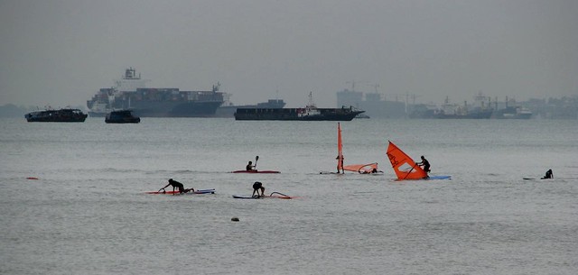
The Strait of Malacca is a narrow, 805 km (500 mile) stretch of water between the Malay Peninsula (Peninsular Malaysia) and the Indonesian island of Sumatra. From an economic and strategic perspective, the Strait of Malacca is one of the most important shipping lanes in the world.
The strait is the main shipping channel between the Indian Ocean and the Pacific Ocean, linking major Asian economies such as India, China, Japan and South Korea. Over 50,000 vessels pass through the strait per year, carrying about one-quarter of the world's traded goods including oil, Chinese manufactures, and Indonesian coffee.
About a quarter of all oil carried by sea passes through the strait, mainly from Persian Gulf suppliers to Asian markets such as China, Japan, and South Korea. In 2006, an estimated 15 million barrels per day (2,400,000 m3/d) were transported through the strait.
The maximum size of a vessel that can make passage through the Strait is referred to as Malaccamax. The strait is not deep enough (at 25 metres or 82 feet) to permit some of the largest ships (mostly oil tankers) to use it. A ship that exceeds Malaccamax will typically use the Lombok Strait, Makassar Strait, Sibutu Passage and Mindoro Strait instead.
At Phillips Channel close to the south of Singapore, the Strait of Malacca narrows to 2.8 km (1.5 nautical miles) wide, creating one of the world's most significant traffic choke points.
Bab-el-Mandeb

The Bab-el-Mandeb meaning "Gate of Scars" in Arabic, is a strait located between Yemen, on the Arabian Peninsula, Djibouti and Eritrea, north of Somalia, in the Horn of Africa, and connecting the Red Sea to the Gulf of Aden. It is sometimes called the Mandab Strait in English.
Bab el-Mandab acts as a strategic link between the Indian Ocean and the Mediterranean Sea, via the Red Sea and the Suez Canal. In 2006, an estimated 3.3 million barrels (520,000 m3) of oil passed through the strait per day, out of a world total of about 43 million barrels per day (6,800,000 m3/d) moved by tankers.
The distance across is about 20 miles (30 km) from Ras Menheli in Yemen to Ras Siyan in Djibouti. The island of Perim divides the strait into two channels, of which the eastern, known as the Bab Iskender (Alexander's Strait), is 2 miles (3 km) wide and 16 fathoms (30 m) deep, while the western, or Dact-el-Mayun, has a width of about 16 miles (25 km) and a depth of 170 fathoms (310 m). Near the coast of Djibouti lies a group of smaller islands known as the "Seven Brothers". There is a surface current inwards in the eastern channel, but a strong undercurrent outwards in the western channel.
Strait of Dover

The Strait of Dover or Dover Strait is the strait at the narrowest part of the English Channel. The shortest distance across the strait is from the South Foreland, some 4 miles (6 kilometres) north east of Dover in the county of Kent, England, to Cap Gris Nez, a cape near to Calais in the French département of Pas-de-Calais, France. Between these two points lies the most popular route for cross-channel swimmers as the distance is reduced to 34 km (21 mi).
Most maritime traffic between the Atlantic Ocean and the North and Baltic Seas passes through the Strait of Dover, rather than taking the longer and more dangerous route around the north of Scotland. The strait is the busiest international seaway in the world, used by over 400 commercial vessels daily. This has made safety a critical issue, with HM Coastguard maintaining a 24-hour watch over the strait and enforcing a strict regime of shipping lanes.
Strait of Hormuz
The Strait of Hormuz is a narrow, strategically important waterway between the Gulf of Oman in the southeast and the Persian Gulf. On the north coast is Iran and on the south coast is the United Arab Emirates and Musandam, an exclave of Oman.
The strait at its narrowest is 54 kilometres (29 nmi) wide. It is the only sea passage to the open ocean for large areas of the petroleum-exporting Persian Gulf. According to the U.S. Energy Information Administration, an average of about 15 tankers carrying 16.5 to 17 million barrels of crude oil normally pass through the strait every day, making it one of the world's most strategically important choke points. This represents 40% of the world's seaborne oil shipments, and 20% of all world shipments.


.jpg)


No comments:
Post a Comment